"Basically,
autumn is a transition season as the thunderstorms and severe weather of the
summer give way to a tamer, calmer weather period before the turbulence of the
winter commences." I wrote that sentence back in 1996 when doing research on Indian Summers which was one of my most popular articles. Look for the *article at the bottom of this Outlook.
Autumn 2013 Outlook
Temperatures
Indications are temperatures this
fall will be quite variable (even more than usual see Upper Wind
Discussion below) but in the end, temperatures should average near normal to below (or
-1.5 to +0.5 degrees of normal). The data in our neutral analogue falls remains
quite mixed and looking at that, along with the upper wind projections, suggest
end results will average near normal to below.
Precipitation
Precipitation over the area is
projected to average around normal to above in keeping with our recent trend.
The ENSO pattern over the Pacific Ocean is expected to hold in the Neutral
state through the fall. Since the ENSO state will hold Neutral, this
leaves very little to go on for the fall period in regards to influencing
patterns for the Great Lakes from the Pacific and not unlike our recent summer.
Upper Wind Discussion
Upper air general projections indicate normal
ridging oscillating with a deepening troughing pattern early to mid fall. By mid
to late fall more troughing will extend from mid and eastern Canada into the upper Midwest and Great Lakes. While this is in
agreement with the normal or average season change; early indications are upper
wind patterns including the Polar jet over the Arctic extending into Canada will
become more aggressive than average and dip south. In addition, our Neutral
Autumn analogues also suggest more below normal temperatures as the fall
unfolds.
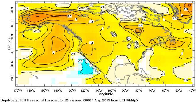
Latest model guidance intimates an average to slightly above average overall. This data lies more heavily on very recent trends.


On to the Analogues
Latest model guidance intimates an average to slightly above average overall. This data lies more heavily on very recent trends.

On to the Analogues
Our most
recent Autumn Analogue to this fall occurred in 2008 when neutral conditions
persisted from the summer. While the summer of 2009 was also basically Neutral ENSO, the following autumn evolved into
an El Nino...not expected this year. Looking at the data from the Autumn of
2008 gives us the following;
AUTUMN 2008 TEMPERATURES/DEPARTURES
LOCATION SEPTEMBER OCTOBER NOVEMBER FALL
LOCATION SEPTEMBER OCTOBER NOVEMBER FALL
DETROIT
|
66.3
/ +2.4
|
50.6
/ -1.3
|
39.0
/ -1.7
|
52.0 / -0.2
|
62.7 / +2.0
|
49.2 / -1.5
|
37.3 / -0.8
|
49.7 /+0.4
|
|
SAGINAW
|
62.1
/ +2.1
|
47.7
/ -1.5
|
37.8
/ -0.2
|
49.2 / -0.2
|
AUTUMN 2008 PRECIPITATION/DEPARTURES
LOCATION SEPTEMBER OCTOBER NOVEMBER FALL
DETROIT
|
5.99/+2.72
|
1.15/- 1.08
|
3.31/+ 0.65
|
10.45/+2.29/20th
wettest
|
FLINT
|
8.64/+4.88
|
1.26/-1.08
|
2.10/-0.55
|
12.00/+3.25/6th
wettest
|
SAGINAW
|
4.55/+0.60
|
2.26/- 0.23
|
1.47/-1.18
|
8.28/-0.81
|
Looking at our earlier
Neutral analogue fall statistical package (below) and comparing it to our most recent Neutral fall
2008 data (above) holds us in good stead and thus, continues to be useful. Data
from all analogues was extremely mixed and basically, there are as many of
warmer falls as cooler with some normal falls tossed in for good measure. In
addition, the same can be said about the precipitation side of things with some
dry falls, wets falls and near normal falls. This “equal-parts”
variability is somewhat unusual and one of the most mixed season data set seen.
NEUTRAL ANALOGUE AUTUMNS

(Normals 1971-2000)
(Normals 1971-2000)
In this smorgasbord of weather are there even
any subtle trends? Not really other than there were notable wet and dry falls,
similar to preceding summers. Keeping one eye on our recent rainfall
trends and the other on the 2008 period, I'm inclined to keep rainfall
projections at least around normal if not above.
How about monthly trends? Temperatures in
September and October were mixed with little in the way of prevalent trends.
Novembers did show a bit more consensus toward a cooler than normal, but even
that wasn’t a strong trend. Overall, the composite charts for the fall do
indicate temperatures averaging a degree or so below normal for Southeast Lower
Michigan while precipitation averages around normal.


Frost and Freeze Trends:
Our guidance indicates temperatures are
quite variable and most years our frosts and freezes were on schedule. Checking
back on the years in our study reveals some common frost/freeze statistics.
Using our stats from Detroit, (and estimates of
frost when most areas saw overnight lows fall in the lower to mid 30s for the
first time). Our analogue falls show the risk of frost and/or freeze the last
week of September into the first week of October. This is right in there with
the average frost dates. The more widespread freezes occurred by the third week
of October.
Indian Summer this Fall?
Perusing our analogue autumns, the likelihood
of a period or two of Indian Summer weather this fall looks promising. Note,
most temperature patterns in October and November varied considerably in the
analogue years, this is generally a prerequisite for Indian Summer falls. You
want a progressive amplified upper wind pattern during the fall to deliver
large cold high pressure systems. While these highs can bring sharp cold
snaps (and attending solid frost/freezes, necessary for Indian Summers), after
they move east, impressive strong warm-ups, sometimes lasting as long as a
weeks bring Indian Summer weather…let’s hope.
Notable Autumnal Dates
Harvest Moon: Thursday - Sep 19th, 2013 (Traditionally, this
designation goes to
the full moon that occurs closest to the
Autumnal (fall) Equinox. The Harvest Moon
usually comes in September, but
about every three or four years it will fall in early
October - closest full moon to the
beginning of fall).
Autumn Officially Begins: Sunday - September 22nd, 2013 at 444PM EDT
Average First Freeze Date: October
21st (Detroit area), October 11th (Flint and
Saginaw area)
Halloween:
Thursday, October
31st, 2013
Thanksgiving:
Thursday, November 28, 2013 (latest possible)
Have a nice fall and look for my Winter
2013-14 Outlook early in November
*Indian Summer
http://weatherhistorian.blogspot.com/2013/09/just-what-is-indian-summer-and-did.html
Making weather fun while we all learn,
Bill Deedler -SEMI_WeatherHistorian
Bill Deedler -SEMI_WeatherHistorian
No comments:
Post a Comment