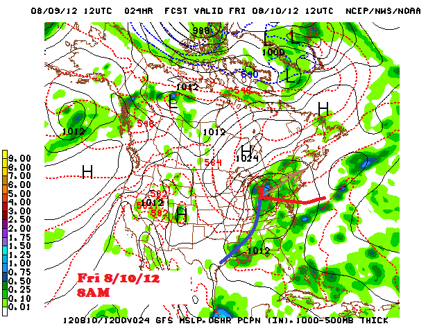
This type of weather has not been seen since the first week of June and even then; it was not as wet and temperatures were closer to normal for that time. The current stretch of cool weather will contain high temperatures from the mid 60s to mid 70s through Saturday; or about 7 to 15 degrees below the normal high temperatures, depending on the day and location across Southeast Lower Michigan. The "lousiest" of the weather in regards to cool and wet conditions will encompass the region today into mid-day Saturday.
Surface Map
Rainfall estimates
It wasn't too long ago many residents of Southeast Lower Michigan were dreaming of a cool and wet period with day after day of hot and dry weather...so now it's here and we could use it. Though the rains have picked up lately; dry to drought conditions still prevail over much of the region and worsen to the south /Map -3/. While the rain may spoil some plans; it is a blessing for the landscape and vegetation.
The estimated amounts of rain needed across the country to alleviate the drought as of early August is astounding (see map below). Of course; ideally this would be over an extended period of time. You certainly wouldn't want some of this rain in a couple of days or even weeks...or major flooding would occur!
Making weather fun while we all learn,
Bill Deedler - SEMI_WeatherHistorian


