Feb 14, 2022

Super Snow For Super Bowl Sunday...Touchdown! (snowfall reports through 2/2/15)_*Updated Feb 14th 2022_Seven Year Anniversary of Super Bowl

SNOWFALL TOTALS FROM SUPER BOWL SUNDAY'S SNOWSTORM 2015


DETROIT'S SNOW TOTAL OF 16.7" FOR 2/1 - 2/2/15, PUT IT IN 3RD PLACE FOR
BIGGEST SNOWSTORM ON RECORD GOING BACK TO 1880.

Snowfall Totals from the February 1-2, 2015 Winter Storm /NWS - DTX/

February started off quite active, as a long duration snow event unfolded across the region bringing the first significant snowfall to Southeast Michigan this winter season.  Over the past few months, the area had managed to avoid a lot of the snow while other states have not had such luck.  Up through the end of January, areas were below normal for snowfall compared to the record breaking winter season of '13-'14.  Then came the storm that ended up dropping over a foot of snow at Detroit Metro Airport!

A  strong low pressure system developed across the Great Plains and drifted across lower Michigan on Sunday and Sunday night. Snow began in the southern counties around 1am Sunday and snowed continuously throughout the day on Sunday. Better moisture arrived by mid-afternoon resulting in heavier snowfall rates (up to an inch per hour in some locations). The system finally pushed east of the region round 7am Monday morning. This long duration winter storm resulted in snowfall totals between 9 and 15 inches across the Metro Detroit area, with slightly lower amounts across the Thumb and Saginaw Valley regions (3-6 inches). 

Radar loop courtesy of Iowa Environmental Mesonet (IEM).  Peach colored boxes are winter weather advisories and pink boxes are winter storm warnings.


PNSDTX
MIZ047>049-053>055-060>063-068>070-075-076-082-083-021730-
PUBLIC INFORMATION STATEMENT...STORM TOTALS
NATIONAL WEATHER SERVICE DETROIT/PONTIAC MI
1048 AM EST MON FEB 2 2015
STORM TOTAL SNOW REPORTS
LOCATION                  SNOWFALL     DURATION
                          (INCHES)      (HOURS)        LAT       LON
...BAY COUNTY...
   AUBURN                  M   7.2           24     43.60N    84.08W
...GENESEE COUNTY...
   GOODRICH                M   8.5           27     42.92N    83.51W
   4 N BURTON              M   8.9           27     43.05N    83.62W
   7 W FLINT               M   8.9           26     43.02N    83.83W
   FLINT                   M   9.2           28     43.02N    83.69W
   LINDEN                  M  10.2           28     42.82N    83.78W
...HURON COUNTY...
   5 NNW FILION            M   4.2           24     43.96N    83.04W
   BAD AXE                 M   6.0           25     43.80N    83.00W
...LAPEER COUNTY...
   4 E DAVISON             M  11.0           24     43.03N    83.44W
   LAPEER                  M  11.9           28     43.05N    83.32W
   2 W LAPEER              M  12.3           28     43.05N    83.36W
...LENAWEE COUNTY...
   2 WSW TIPTON            M   9.5           30     42.01N    84.10W
   MORENCI                 M  11.7           30     41.72N    84.22W
...LIVINGSTON COUNTY...
   HOWELL                  M  10.2           28     42.61N    83.94W
   1 N WHITMORE LAKE       M  11.0           29     42.44N    83.75W
   BRIGHTON                E  12.5            M     42.53N    83.78W
...MACOMB COUNTY...
   1 NW ROSEVILLE          M  10.0           26     42.52N    82.95W
   4 NNW RICHMOND          M  11.7           28     42.86N    82.78W
   SHELBY TOWNSHIP         M  15.5           25     42.67N    83.03W
...MIDLAND COUNTY...
   MIDLAND                 M   4.0           24     43.62N    84.23W
   OIL CITY                M   6.0           24     43.61N    84.59W
...MONROE COUNTY...
   DUNDEE                  M  12.0           30     41.96N    83.66W
   CARLETON                M  13.1           29     42.06N    83.39W
   MONROE                  M  14.0           28     41.92N    83.39W
   3 SW MONROE             M  15.0           30     41.89N    83.43W
   4 SSE NEWPORT           M  15.0           30     41.95N    83.28W
...OAKLAND COUNTY...
   1 N FARMINGTON HILLS    M   9.0           28     42.50N    83.38W
   HOLLY                   M   9.0           28     42.80N    83.62W
   FARMINGTON HILLS        M   9.2           28     42.49N    83.38W
   CLARKSTON               M   9.5           28     42.74N    83.42W
   FARMINGTON              M  10.6           28     42.46N    83.38W
   2 S ORTONVILLE          M  11.0           28     42.82N    83.44W
   WHITE LAKE              M  11.2           28     42.65N    83.50W
   4 N NOVI                M  11.5           26     42.53N    83.49W
   4 N LIVONIA             M  12.3           28     42.46N    83.37W
   1 ENE ROCHESTER         M  13.1           26     42.69N    83.10W
   NW SOUTH LYON           M  13.7           28     42.46N    83.65W
   2 NW WATERFORD          M  14.0           28     42.68N    83.42W
   LAKEVILLE               M  14.0           28     42.82N    83.15W
   2 SE LEONARD            M  15.0           30     42.85N    83.12W
...SAGINAW COUNTY...
   5 S MERRILL             M   5.0           24     43.34N    84.34W
   2 E MERRILL             M   6.0           26     43.41N    84.30W
   FRANKENMUTH             M   7.4           27     43.33N    83.74W
   HEMLOCK                 M   7.5           24     43.42N    84.23W
   SAGINAW                 M   7.5           27     43.42N    83.95W
   CHESANING               M   7.7           27     43.18N    84.12W
...SANILAC COUNTY...
   LEXINGTON               M  10.0           24     43.27N    82.53W
   SANDUSKY                M  10.0           24     43.42N    82.83W
...SHIAWASSEE COUNTY...
   2 NE CORUNNA            M   7.0           24     43.00N    84.09W
  6 WNW DURAND             M  10.5           28     42.95N    84.10W
   OWOSSO                  M  10.5           28     43.00N    84.18W
   SHAFTSBURG              M  13.2           28     42.80N    84.29W
...ST. CLAIR COUNTY...
   1 NNW YALE              M  12.2           28     43.14N    82.80W
   COLUMBUS                M  12.3           25     42.89N    82.67W
   ALGONAC                 M  14.0           27     42.62N    82.53W
...TUSCOLA COUNTY...
   CARO                    M   5.5           26     43.49N    83.40W
   1 SSW CASS CITY         M   6.5           28     43.59N    83.18W
   VASSAR                  M   7.0           26     43.37N    83.58W
...WASHTENAW COUNTY...
   SALINE                  M   9.5           29     42.18N    83.78W
   2 WNW ANN ARBOR         M  12.0           29     42.29N    83.77W
   SALEM                   M  12.0           28     42.41N    83.58W
   CHELSEA                 M  12.2           29     42.31N    84.02W
   3 SW YPSILANTI          M  12.8           29     42.21N    83.66W
   MANCHESTER              M  13.0           29     42.15N    84.04W
   SE ANN ARBOR            M  13.5           29     42.28N    83.73W
   ANN ARBOR               M  14.1           29     42.28N    83.73W
   3 NNW MILAN             M  15.0           29     42.13N    83.72W
...WAYNE COUNTY...
   GROSSE POINTE FARMS     M   9.5           29     42.40N    82.89W
   DEARBORN                M   9.6           29     42.31N    83.21W
   3 NE DEARBORN           M  10.0           29     42.34N    83.17W
   1 NW DEARBORN HEIGHTS   M  12.8            M     42.34N    83.29W
   2 NNW LIVONIA           M  13.5           29     42.42N    83.39W
   GARDEN CITY             M  13.5           29     42.33N    83.33W
   ALLEN PARK              M  14.0           28     42.26N    83.21W
   NORTHVILLE              M  14.2           30     42.44N    83.49W
   1 WSW DEARBORN          M  14.5           29     42.31N    83.23W
   WYANDOTTE               M  16.5           28     42.21N    83.16W
   ROMULUS                 M  16.7           28     42.22N    83.37W
   BROWNSTOWN TOWNSHIP     M  17.0           28     42.15N    83.26W
M = MEASURED
E = ESTIMATED
 
 
_______________________________________________________________
 
Update 2/1/15 - Posted 240PM 2/1/15
 
As discussed the past few days; our ongoing snowstorm has shown increasing classic 
atmospheric phasing; resulting in an outstanding moisture supply and good dynamics for
a major snowstorm across much of Southeast Lower Michigan  (see blog updates below
this update)! Yesterday and this morning; the Weather Prediction Center of the NWS in Maryland  
agreed with my analysis yesterday (update 1/31/15) on why we had/have the makings of a major, 
notable snowstorm across the Southern Great Lakes and Northern Ohio Valley (see below): 
 
PROBABILISTIC HEAVY SNOW AND ICING DISCUSSION
NWS WEATHER PREDICTION CENTER COLLEGE PARK MD
420 PM EST SAT JAN 31 2015

VALID 00Z SUN FEB 01 2015 - 00Z WED FEB 04 2015
 
...CENTRAL PLAINS/MID TO UPPER MISSISSIPPI VALLEY TO NORTHEAST...

QUITE POSSIBLY THE MOST EXTENSIVE WINTER STORM OF THE SEASON WILL
IMPACT PARTS OF THE MIDWEST INTO THE NORTHEAST ON SUN AND MON.  AN
AGGRESSIVE AND SHARP NORTHERN STREAM SHORTWAVE TROUGH WILL AMPLIFY
OVER THE NORTHERN/CENTRAL PLAINS ON SUNDAY AS IT INCORPORATES
SOUTHERN STREAM DYNAMICS AND ANOMALOUS MOISTURE CONTENT EMANATING
FROM THE SOUTHWEST. THIS WILL RESULT IN A SURFACE WAVE DEVELOPING
SUN MORNING OVER THE LOWER MO/MID MS VALLEYS. THIS LOW IS EXPECTED
DEEPEN AND TRACK EASTWARD...REACHING THE LOWER OH VALLEY BY SUN
EVENING AND THE UPPER OH VALLEY/CENTRAL APPALACHIANS BY MON
MORNING.  ANOMALOUS PWS FROM MID-HIGH LEVEL MOISTURE FROM THE
PACIFIC/SUBTROPICAL JET AND LOW-LEVEL GULF OF MEXICO MOISTURE WILL
SURGE OVER AN EXPANDING COLD SECTOR ASSOCIATED WITH A POLAR/ARCTIC
SURFACE RIDGE. THE TREND OF THE GUIDANCE OVER THE LAST FEW DAYS IS
TO GRADUALLY SHIFT NORTHWARD THE WEST TO EAST AXIS OF FROZEN
PRECIP. FOR DAY 1...SUN MORNING INTO EARLY MON...THE GUIDANCE HAS
SETTLED ON A HEAVY SNOWFALL AXIS ALONG THE MICH/IND/OH BORDERS
INTO THE LOWER LAKES REGION...WHERE A SLIGHT TO MODERATE
PROBABILITY OF A FOOT OR MORE HAS BEEN INDICATED.

The latest prognostication, surface, radar and satellite data all continue this trend with 
just a slight upward tweaking of both amounts and area coverage. I do believe we will 
most likely place in the top 25 biggest snowstorms at Detroit with a good chance in the 
foot or better category.
 
SNOWSTORM TOTALS AND WEATHER FORECAST:

Snow, heavy at times with considerable blowing and drifting later afternoon into the night. Winds will pick up from northeast at 15 to 25 mph and gusty, becoming north on Monday. Snowfall, with considerable blowing and drifting snow will create near blizzard conditions at times (the winds must at least frequently gust to 35 MPH for a blizzard). Temperatures will drop to around 8 far north to teens south by Monday morning. Ironically, Monday morning is Groundhog Day and I suspect he might be buried and downright crabby if he is pulled out of his hutch; both here and in Punxsutawney Pennsylvania!

Snow Amount Estimates:
Again; I feel the general model trend and intensification are better inline to what I'm seeing most likely for the event: There will be a somewhat sharp line of demarcation from north to south with this system with highest amounts generally to the south of the delineated area. Look for 4" - 7" north/south in the Saginaw Valley and Thumb Region;  7" -  around 12" from the Flint area east across to Port Huron (I-69) and then; south into the Ann Arbor area to Metro Detroit. Further south across the 1-94 corridor to the Ohio border; 12 - 14+" of snow is possible.
 
____________________________________________________________________________ 
 
Update -1/31/15 - Posted 343 PM 1/31/15
 
First of all up front; let's define Super Snow; when I first sent that out in the title I was thinking of one of our bigger snowstorms in Southeast Lower Michigan; particularly in Detroit where the heaviest snow of the three cities was expected (and still is). I had envisioned of snowstorms of a foot or more when looking at the chart below. As one can see by the chart in which I developed years ago at the NWS for the net (and is kept up to date by the NWS), it's not that easy to officially get a foot or more with just 12 times since 1880 it happening (good way to remember; 12 for 12). Therefore; I thought that would be a good place to start when using the play on words and title "Super Snow For Super Bowl Sunday" At that time, the chances looked fairly low for a foot or more when first issued. Now I'm not so sure they are that low...


Detroit's Heaviest Snow Storms

RankDateAmount
1 April 6, 1886 24.5
2 December 1-2, 1974 19.3
3 March 4-5, 1900 16.1
4 February 28-March 1, 1900 14.0
5 December 18-19,1929 13.8
6 February 12-13 1894 12.8
7 February 19, 1908 12.6
8 January 31-February 1,1881 12.5
9 February 9,1911 12.3
10 March 3-4,1895 12.3
11 January 22-23,2005 12.2
12 January 13-14,1927 12.1
13 January 30-31,1982 11.8
14 January 13-14,1910 11.4
15 March 4-5,1899 11.4
16 January 2-3, 1999 11.3
17 December 19-20, 1973 11.2
18 February 3-4,1901 11.2
19 March 7-8, 1931 11.1
20 January 13-14, 1992 11.1
21 December 31, 2013-January 2, 2014 11.1
22 February 25-26, 1965 11.0
23 December 4-5, 1898 10.6
24 January 4-5, 2014 10.6
25 January 6, 1994 10.3

*NOTE: DETROIT'S 16.7" SNOW TOTAL FOR 2/1-2/2/15 PUT IT 3RD PLACE FOR BIGGEST SNOWSTORM ON RECORD GOING BACK TO 1880.

*Updated 01302020*


Detroit's Heaviest Snow Storms
Rank
Date
Amount
1
April 6, 1886
24.5
2
December 1-2, 1974
19.3
3
February 1-2, 2015
16.7
4
March 4-5, 1900
16.1
5
February 28-March 1, 1900
14.0
6
December 18-19,1929
13.8
7
February 12-13 1894
12.8
8
February 19, 1908
12.6
9
January 31-February 1,1881
12.5
10
February 9,1911
12.3
11
March 3-4,1895
12.3
12
January 22-23,2005
12.2
13
January 13-14,1927
12.1
14
January 30-31,1982
11.8
15
January 13-14,1910
11.4
16
March 4-5,1899
11.4
17
January 2-3, 1999
11.3
18
December 19-20, 1973
11.2
19
February 3-4,1901
11.2
20
March 7-8, 1931
11.1
21
January 13-14, 1992
11.1
22
December 31, 2013-January 2, 2014
11.1
23
February 25-26, 1965
11.0
24
December 11, 2016
10.7
25
January 4-5, 2014
10.6


Latest guidance has ramped up a major (or worst - best if you are snowstorm nut) snowstorm for extreme Southeast Lower Michigan; while still somewhat lesser amounts north of the Flint into Port Huron. As mentioned in previous blog last night; the moisture and dynamics with this system were coming together for this to be a better, more developed Ohio Valley storm that actually slows down some as it approaches western Pennsylvania on Monday.

It's been my observation over the years, usually these St Louie lows are good achievers (but still not as good as the Gulf Low) in their own right as they "paddle-boat" moisture in from the Gulf while they form and develop while moving across the Ohio Valley. What was originally missing like many times (or at least was questionable) was the phasing or interaction of the dynamics in the upper levels to affect the lower levels of the atmosphere. These dynamics are in the form of short wave energy from the northern Pacific, southern Canada and the Central Pacific - which is observed as a "Cut-off Low" (cut off from the main jet stream). Therefore; the amount of energy that was needed to come together to lift and support the increasing moisture pulled north from the SW and Gulf was questionable to produce a major storm.

This distant player in this system is indeed, the large upper low system of the Baja area of California into the Southwest. Even while remaining nearly stationary, it still has been able to pinwheel spokes of energy and moisture from the Pacific over the southwest part of the country. This moisture has been pushed broadly upward into the south and even central part of the country. While the main system stays put, still enough energy and moisture is forecast to be tapped to aid in development of this major Ohio Valley system. See maps and explanations below:

Snowfall and weather forecast:

Snow will commence during the early morning hours of Sunday. Look for the snow to become heavy at times as the day wears on along with a stiffening northeast wind at 10 to 20 mph. Snow, heavy at times with considerable blowing and drifting later afternoon into the night. Winds will pick up from northeast at 15 to 25 mph and gusty, becoming north on Monday. Considerable blowing and drifting snow with temperatures dropping into the teens to lower 20s by Monday morning. Ironically, Monday morning is Groundhog Day and I suspect he might be buried and downright crabby if he is pulled out of his hutch; both here and in Punxsutawney Pennsylvania!

Snow Amount Estimates:
I feel the general model trend and intensification are better inline to what I'm seeing most likely for the event: There will be a rather sharp line of demarcation from north to south with this system with highest amounts generally to the south of the delineated area. Look for 2" - 4" north/south in the Saginaw Valley and Thumb Region; 5" -  10" from the Flint area east across to Port Huron and then; south into the Ann Arbor area to Metro Detroit. Further south across the Southeast corner of Lower Michigan 8" - 12" of snow is possible. If the storm deepens further and slows down more - some isolated 12"+ amounts are possible in those areas.


Latest European Model Monday Morn 2/2/15:

Making weather fun while we all learn,
Bill Deedler -SEMI_WeatherHistorian

Feb 2, 2022

"Someone's Gonna' Get Clobbered" ~ But Who? Another Groundhog Snowstorm in Our Future - Update Forecast Wednesday 7am 2/2/22

The talk in the weather-land is what will happen with an extended period of overrunning evolving midweek as a cold front slides slowly southeast and stalls over the Northern Ohio Valley. First let me say; this is not a typical low pressure system developing in the Ohio Valley, deepening and moving northeast into the Eastern Lakes and out of the area. True; heavy amounts of snow usually are associated with that system but its affect is shorter-lived, usually about 12-18 hours depending on movement. If the system gets "stacked" all levels of the atmosphere as it matures, it can hold longer. That usually happens in the Northern Lakes, Canada or Northeast.

Overrunning in a "Sling-Shot" Fashion

What is expected to happen this week is the cold front moves down into the Ohio Valley back into the southern Midwest and stalls. In the meantime; weak waves of low pressure and extensive overrunning occurs in and southwest to northeast trajectory as the front gets hung up and becomes parallel to this basic "sling-shot" pattern. Energy in the upper levels of the atmosphere are forecast to stream out from the South-Southwest Region to the Northern Ohio Valley. Years ago in my early days I learned about this "Sling Shot" pattern from a few of the Old Timer Forecasters when a upper air trough formed over the Southwest in the Arizona/New Mexico and energy ejects and streams northeast into the Great Lakes/Ohio Valley.  When copious moisture was available for a longer term stalled system, I can hear the phase "Someone's gonna' get Clobbered" back in the old days from a revered forecaster back in his day: Frank Grabowski of Livonia (I assume he since has passed away, he would be around 100). I always looked forward working with him as he was smart, good intuition, loved electronics, down to earth and sometimes unintentionally; humorous, one of my favorite forecasters - but I intentionally digress.

As cold Polar or Arctic air hovers over the Northern Plains and Great Lakes while milder air, sometimes with copious moisture, streams over the stationary front that forms at the surface and aloft; then causes precipitation mainly north of the front into the colder air as light to heavy light snow (depending on moisture that is available) many times from the Gulf of Mexico. The forecasters can be leery of this setup because it can last for long periods and what falls can be damaging; especially freezing rain as the cold air hugs the ground and above freezing air flows up in the atmosphere and liquid precipitation accumulates on the ground as ice. Forecasters can also be leery for another reason when this pattern was forecast; WHO will get clobbered? It's very easy to miss on this forecast because as we know, the atmosphere sometimes doesn't do what our models suggest. That is why it's better to step into this forecasted pattern (and various outcomes have already come up with different models) slowly and not be too extreme days ahead. Thus a Winter Storm Watch was issued by the NWSDTX today - and one of the reasons it was developed decades ago. 

Ok; so what are we in Southeast Lower Michigan looking at with this winter system? Well; I've pretty much explained the pattern expected so lets look at the model projections. As you will see there is a wide ranging snowfall amounts expected just in our region, alone. The important thing is this latest run, the models are coming more inline; especially our big ones GFS & Euro with NAM and Canadian joining the pack, Both Euro and Canadian have come more inline with GFS. All models are from 12Z /7am est/ Mon 1/31 except NAM which is the later run at 18Z. Also Euro snowfall is the standard 10/1 ratio. Snowfalls are expected to sharply fall off into the northern areas of Southeast Michigan.

7Am Update, Wed- 2/1/22 (Forecast section) Previous thinking of second wave of Low Pressure just clipping the SE corner /Ann Arbor to Metro Detroit, south/ still looks likely . A slower change-over to snow overnight due to warmer column of air before the change over - and break in the action overnight Thursday will cut in snowfall amounts somewhat across mainly the southern region. Forecast wording and snowfalls lowered for ranges. Snow, moderate to heavy at times is expected today with a lull in the action overnight. Snow picks up again across extreme SE Mich Thursday diminishing off to flurries Thursday evening.

Snowfalls -

1-Ohio border north through Adrian and Monroe to I-94 corridor; Total snow accumulations 9 - 14" with isolated pockets of higher totals possible.


 2-Ann Arbor into Detroit /north of I-94 to I-696 region/ including Detroit's immediate northern suburbs into Lake St Clair communities; 8 - 12” with isolated pockets of higher totals possible.

3- Further north extending from northern areas of 2, up into the Flint area across I-69 corridor through Lapeer into Port Huron and Southern Lake Huron communities; 6 - 10".

4- Across the Saginaw Valley into Thumb Region; 1-2” far northern region around Midland and Saginaw Bay and 3-6" Saginaw into mid Thumb area.

Making weather fun while we all learn,
Bill Deedler - SEMI_WeatherHistorian

Jan 31, 2022

"Someone's Gonna' Get Clobbered" ~ But Who? Another Groundhog Snowstorm in Our Future

The talk in the weather-land is what will happen with an extended period of overrunning evolving midweek as a cold front slides slowly southeast and stalls over the Northern Ohio Valley. First let me say; this is not a typical low pressure system developing in the Ohio Valley, deepening and moving northeast into the Eastern Lakes and out of the area. True; heavy amounts of snow usually are associated with that system but its affect is shorter-lived, usually about 12-18 hours depending on movement. If the system gets "stacked" all levels of the atmosphere as it matures, it can hold longer. That usually happens in the Northern Lakes, Canada or Northeast.

Overrunning in a "Sling-Shot" Fashion

What is expected to happen this week is the cold front moves down into the Ohio Valley back into the southern Midwest and stalls. In the meantime; weak waves of low pressure and extensive overrunning occurs in and southwest to northeast trajectory as the front gets hung up and becomes parallel to this basic "sling-shot" pattern. Energy in the upper levels of the atmosphere are forecast to stream out from the South-Southwest Region to the Northern Ohio Valley. Years ago in my early days I learned about this "Sling Shot" pattern from a few of the Old Timer Forecasters when a upper air trough formed over the Southwest in the Arizona/New Mexico and energy ejects and streams northeast into the Great Lakes/Ohio Valley.  When copious moisture was available for a longer term stalled system, I can hear the phase "Someone's gonna' get Clobbered" back in the old days from a revered forecaster back in his day: Frank Grabowski of Livonia (I assume he since has passed away, he would be around 100). I always looked forward working with him as he was smart, good intuition, loved electronics, down to earth and sometimes unintentionally; humorous, one of my favorite forecasters - but I intentionally digress.

As cold Polar or Arctic air hovers over the Northern Plains and Great Lakes while milder air, sometimes with copious moisture, streams over the stationary front that forms at the surface and aloft; then causes precipitation mainly north of the front into the colder air as light to heavy light snow (depending on moisture that is available) many times from the Gulf of Mexico. The forecasters can be leery of this setup because it can last for long periods and what falls can be damaging; especially freezing rain as the cold air hugs the ground and above freezing air flows up in the atmosphere and liquid precipitation accumulates on the ground as ice. Forecasters can also be leery for another reason when this pattern was forecast; WHO will get clobbered? It's very easy to miss on this forecast because as we know, the atmosphere sometimes doesn't do what our models suggest. That is why it's better to step into this forecasted pattern (and various outcomes have already come up with different models) slowly and not be too extreme days ahead. Thus a Winter Storm Watch was issued by the NWSDTX today - and one of the reasons it was developed decades ago. 

Ok; so what are we in Southeast Lower Michigan looking at with this winter system? Well; I've pretty much explained the pattern expected so lets look at the model projections. As you will see there is a wide ranging snowfall amounts expected just in our region, alone. The important thing is this latest run, the models are coming more inline; especially our big ones GFS & Euro with NAM and Canadian joining the pack, Both Euro and Canadian have come more inline with GFS. All models are from 12Z /7am est/ Mon 1/31 except NAM which is the later run at 18Z. Also Euro snowfall is the standard 10/1 ratio. Snowfalls are expected to sharply fall off into the northern areas of Southeast Michigan.

Forecast; Updated (Wed 7Am 2/2/22) for wording and dropped snowfall totals somewhat.


Precipitation

Light rain will become mixed with/and change to snow from west to east overnight Tuesday into Wednesday morning. Snow, heavy at times will continue through Wednesday and into Wednesday evening before diminishing off to intermittent snow into Thursday. 


Falling Temperatures

Temps will fall from the mid 30s and into 20s early Wednesday. Then slide down through the 20s and into the teens by later Wednesday. Mainly teens overnight Wednesday and Thursday.


Snowfalls - Highest amounts over the southern areas.


1-Ohio border north through Adrian and Monroe to I-94 corridor; Total snow accumulations 12 - 16" 

2-Ann Arbor into Detroit /north of I-94 to I-696 region/ including Detroit's immediate northern suburbs into Lake St Clair communities; 10 - 14”  

3- Further north extending from northern areas of 2, up into the Flint area across I-69 corridor through Lapeer into Port Huron and Southern Lake Huron communities; 6 - 10".

4- Across the Saginaw Valley into Thumb Region; 1-2” far northern region around Midland and Saginaw Bay and 3-6" Saginaw into mid Thumb area.

GFS


EURO


Keep in mind this is the standard 10/1 ratio snow to rain on the Euro not Kuchera which would be at least a few inches higher due to the colder atmosphere 12-15/1


Canadian


 NAM /18Z/


UK /SNOWFALL ONLY/ The UK is the outlier for snow over SE Mich with the heavier snowfall core further south.


From Heavy snow Discussion from WPC


Notable changes and updates are likely with this storm but in any event; prepare for winter hazardous weather and driving mid to late week.

Making weather fun while we all learn,
Bill Deedler - SEMI_WeatherHistorian


Jan 26, 2022

44 years ago Jan 26-27TH, 1978 ~ A GREAT STORM IS UPON MICHIGAN"

THE GREAT BLIZZARD OF 1978!

Written by: William R. Deedler, Weather Historian - Southeast Lower MI

While I worked countless snowstorms in my long career with the NWS; the two most impressive storms were in order: the January 26-27, 1978 Blizzard and the December 1st, 1974 snowstorm. The huge snowstorm of December 1974 was quite noteworthy in the amount of snow that fell continuously for hours over the Detroit Metro area and portions of Southeast Lower Michigan.

A more powerful (in terms of intensity/extent) storm and remains of strong interest to all meteorologists who have studied winter storms in the Great Lakes is the January 1978 Blizzard. This storm is also of interest and remembrance to many longtime residents of the Great Lakes, the Upper Ohio Valley and Ontario, Canada who had to deal with winter's full fury late in January of 1978. In addition, the storm certainly casts many memories for those of us (author included) who were on duty and worked during the storm while observing in tremendous awe the development and subsequent immense strength of this great monster. With the 44th anniversary of this Great Blizzard at hand, it is worth taking a step back in time to re-live this monumental example of nature's fury.

While there are several contenders for the worst blizzard ever to hit the Great Lakes in relatively modern times (since 1870 when records began in Detroit), the immense and intense Blizzard of January 26-27th 1978 must rank at or near the top along with the Great White Hurricane of 1913 with its similar track and powerfulness.

The incredible Blizzard of January 26-27th, 1978 evolved out of a winter that was infamous for cold and storms. The Winter of 1977-78 thus far had been one the coldest, since records began, in many areas from the Rockies eastward to the Appalachians. Mammoth blizzards occurred late in January and early February from the Midwest to the East Coast as strong Arctic plunges dove south into the country and met up with the warmer winds from the deep south. The winter of 1977-78 was similar to its predecessor (1976-77) in terms of cold. The main difference between the two winters, however, came in February. In 1977, temperatures moderated rapidly during February, while in 1978, the cold actually worsened - with several locations reporting their coldest recorded February to date. The Winter of 1977-78 is written down in the record books as Detroit's seventh coldest winter, Flint's fifth coldest and Saginaw's sixth. West of the Rockies, it was a different story as a dominant upper ridge of high pressure provided a relatively mild winter, with some stations even reporting one of their warmest winters on record.

The Great Storm


Since there were some forecasting variances of the intensity and track of the storm, and considering the primitive model of the day (LFM - Limited Fine Mesh), forecasters did an admirable job in forecasting one of the most severe winter storms ever to hit the Great Lakes Region.

A Winter Storm Watch was posted as early as Tuesday night, the 24th, for the southern half of the Lower Peninsula for Wednesday Night into Thursday. Gale Warnings for the Great Lakes were hoisted the following Wednesday morning, along with the Watch. A weaker system had moved through the region earlier during the day on Tuesday and already dropped some snow on the region (a Winter Storm Watch had been issued for this system as well, earlier on Monday, the 23rd). After Tuesday's snow, the headline on the Special Weather Statement that was issued by the NWS Tuesday evening read as follows: "Another Winter Storm Threatens Lower Michigan" and thus, a second Winter Storm Watch was officially posted.

Meanwhile, the ingredients of what would later prove to be a truly fascinating yet vicious winter storm were coming together from different parts of the country. As with the "White Hurricane of 1913," the massive storm actually began as two smaller but distinct storms. A strong low pressure with an attending arctic air mass was entering the Northern Plains by way of Northern Minnesota on Tuesday evening (24th). At the same time, another developing low pressure system was taking shape over the eastern Texas/Louisiana area.

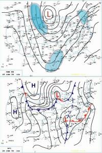
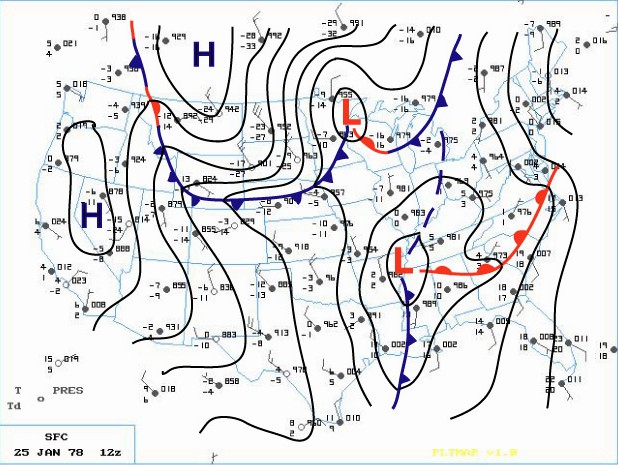
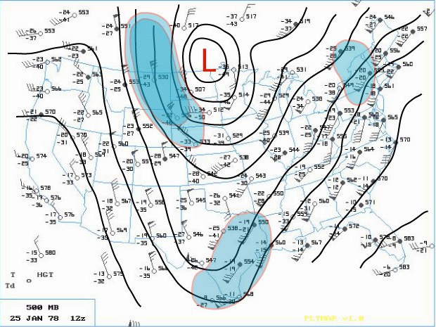
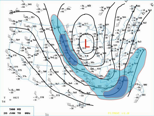
The phasing of two distinct jet streams aloft proved to be the key as to the subsequent strength and massive extent of the storm. A very strong and energetic Arctic impulse surged almost due south and plowed the Arctic front through the Northern Plains late on the 24th. At the same time, another very strong upper wind impulse surged south through southern Arizona. These two jet streaks made up the larger North American jet stream as a huge upper ridge of high pressure along the West Coast of the U.S. diverted the powerful Pacific Jet north into Northern Canada. This northern jet (containing a wind max of 110 knots) then dove due south, like on a giant roller coaster, across the western U.S. as the second, subtropical jet (with an even stronger wind max of 130 knots) surged across southwestern states. On Wednesday (25th), a deepening area of low pressure made its way east across the Gulf States into Georgia by evening (surface | 500mb). Meanwhile, across the north, the Arctic front barreled east across the Upper Midwest into the Western Lakes by Wednesday evening.

Earlier that Wednesday morning, the Winter Storm Watch for Southeast Lower Michigan was changed to a Heavy Snow Warning, while a Travelers Advisory was issued for Western and Northern Lower Peninsula. Later, at the issuance of the evening forecast, the entire Lower Peninsula was upgraded to a Heavy Snow Warning. Meanwhile, a rapid deepening of the surface low over the southeast portion of the country also commenced on Wednesday evening. As the low intensified over Alabama and Georgia, Atlanta registered its lowest barometric pressure ever late on the 25th. At the same time, further north in Michigan, snow was falling over much of the Lower Peninsula. In and around the Ann Arbor and Metro Detroit, the snow mixed with or changed to light rain Wednesday night as slightly warmer air surged northwest into that area ahead of the deepening storm.

While the storm was organizing in the lower levels of the atmosphere over Georgia, the Subtropical and Arctic jet aloft began to merge and phase over the Southeast part of the country. This merging of jet streaks contained a wind max of 150 knots which helped induce a rapid intensification of the Georgia Low as it surged northward into West Virginia early on the 26th. Record low barometric pressures were set all along its path as an ominous track (trough) began to materialize toward the Eastern Great Lakes.

Bands of heavier snow spread north into much of Southern Lower Michigan during the very early morning hours of the 26th. Rain continued to fall, however, over the extreme southeast corner of Lower Michigan. At 1 AM EST, rain was observed at Detroit Metro Airport with the temperature comfortably above freezing at 36 degrees. Further north at Flint, however, sleet and freezing rain were falling as the temperature hovered around freezing. Air pressure tendencies were noted as falling rapidly /PRESFR/ and continued that way for several hours (in fact, several stations in this storms path had to re-adjust their barographs for station pressures traces that were BELOW initial chart scale).

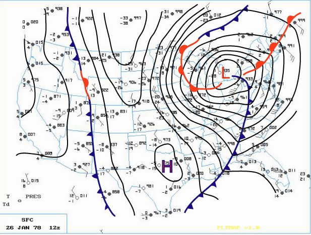
The aforementioned Arctic cold front that was across the Western Great Lakes advanced steadily east into Lower Michigan as the main southern low underwent explosive deepening (this low's central pressure fell 40 millibars in 24 hours)! The central pressure was recorded at 28.28 inches as it tracked north across eastern Ohio, just west of Cleveland, at 7AM EST. As the low moved out over Lake Erie, the Arctic cold front over Southeast Lower Michigan was pulled sharply east into it's mammoth cyclonic circulation. Any residual rain over Southeast Lower Michigan quickly changed to heavy snow and blowing snow during the pre-dawn hours of the 26th. As the Arctic front plowed through the Cleveland area, the wind gusted to an incredible 82 mph! As the Arctic air flooded the Cleveland area, the temperature dropped from a relatively balmy 44 degrees at 4AM EST to a bitterly cold 7 degrees by 1000 AM EST.

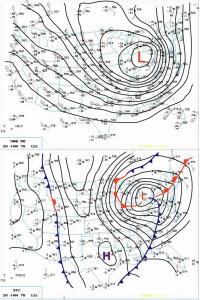
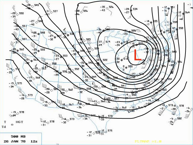
Blizzard Warnings were hoisted across much of the Great Lakes and Upper Ohio Valley Region by daybreak Thursday. The center of the huge storm (surface | 500mb) continued to trek north northwest across Southwest Ontario (roughly between Chatham and London) while Detroit measured its lowest pressure reading at 28.34 inches at 650 AM EST. The incredibly deep center made its way north along the St. Clair River with Sarnia ON reporting the lowest pressure on land at 28.21 inches. Not only was the depth of this mammoth storm's center very impressive, so too was the extent of low pressure from its center. Even locations that were far removed from the storm's center also reported record low pressures. Stations such as Cincinnati OH, Rochester NY and Toronto ON and even as far east as Wilmington N.C., all recorded record low pressure readings from this monster. In fact, at Toronto, where records go back as far back as 1840, the lowest pressure reading of 28.40 inches broke the old record of 28.57 inches by 0.17 inches. In addition, dozens of other cities, with records going back a century, also recorded their lowest pressure reading of all time or, for at least the month of January. This massively intense storm was responsible for strong wind gusts as far away from the center as Boston /72 MPH/ and Chesapeake Bay Bridge /90 MPH/ with even damaging winds reported as far south as Tallahassee FL.

As the Arctic air circulated throughout the storm while it made its way over Lake Huron, the lowest pressure was reached around 950 millibars or a hurricane-like 28.05 inches! "A Great Storm is Upon Michigan" read the headline of the 800 AM EST Special Weather Statement issued by the National Weather Service Forecast Office in Ann Arbor that Thursday /26th/ morning. Heavy snow and blizzard conditions were extensive as wind gusts in excess of 35 mph whipped the snow into huge drifts across much of Southeast Lower Michigan. Other areas of Eastern Michigan, Indiana and Ohio reported near hurricane-force winds, heavy snow and temperatures hovering between zero and 10 above, resulting in extreme blizzard conditions. These conditions later expanded further east into Pennsylvania and West Virginia and prevailed into the night (26-27th) across much of the Eastern Great Lakes, Southern Ontario and the Upper Ohio Valley. With the storm generating copious amounts of snow and very strong winds, whiteout conditions were widespread. All land and air traffic came to a stand still in the affected regions. Several major roads were closed for at least two to three days, if not longer, while clean up got underway. Numerous NWS employees were stranded at work, home, or on the road somewhere between the two. Several employees worked double shifts into at least Friday (some longer) because of the impassable roads with others simply unable to get to work.

The Blizzard Warnings were allowed to die across Michigan during the forenoon hours of Friday, the 27th. Record 24 hour snowfall totals from the storm included, 16.1 inches at Grand Rapids, 15.4 inches at Houghton Lake and 12.2 at Dayton, OH. Snowfalls for the entire storm (25-27th) included a whopping 30.0 inches at Muskegon (some of which was Lake Michigan enhanced), 19.3 inches at Lansing and 19.2 at Grand Rapids. Snowfalls were less over Southeast Lower Michigan (mainly because of the rain that fell for a period) and included 9.9 inches at Flint and 8.2 inches at Detroit.

The following is a quote from the summary written about the storm by Meteorologist in Charge, C.R. Snider on January 30th, 1978 at the National Weather Service Ann Arbor:
"The most extensive and very nearly the most severe blizzard in Michigan history raged throughout Thursday January 26, 1978 and into part of Friday January 27. About 20 people died as a direct or indirect result of the storm, most due to heart attacks or traffic accidents. At least one person died of exposure in a stranded automobile. Many were hospitalized for exposure, mostly from homes that lost power and heat. About 100,000 cars were abandoned on Michigan highways, most of them in the southeast part of the state."
The employees of the National Weather Service Forecast Office in Ann Arbor had just set up shop at the new quarters at the Ann Arbor Federal Building a WEEK before the storm hit. The forecast staff had transferred from the Detroit Metropolitan Airport Office while the observing and radar staff remained at the airport. The majority of employees still lived in and around the metro Detroit area and all major roads between Detroit and Ann Arbor were blocked for approximately 18 hours due to the storm. Several employees put forth efforts beyond the call of duty, stated Mr. Snider in his storm report.

Yet, as mentioned earlier, the Winter was not yet over by any means as the month of February (after the storm) was brutally cold across much of country. The below normal temperature departures of February 1978 were strikingly similar to that of January 1978 (and in some places, February was actually colder). The average temperature for Detroit that winter came in at just 20.5 degrees /normal 27.1/ which again, made it the seventh coldest winter on record. Snowfall totaled a hefty 61.7 inches which made the winter of 1977-78 the ninth snowiest winter on record in Detroit at that time. Flint's average temperature of 19.1 degrees made it the fifth coldest winter on record, but Flint received less snow than Detroit with 50.6 inches. Saginaw's winter average temperature of 17.9 degrees made it the sixth coldest winter on record and was accompanied by 55.6 inches of snow. The 1977-78 snow season at both Flint and Saginaw has since dropped off the top 20 snowiest winters list.

More on the storm in surrounding areas can be found here.

https://www.ncdc.noaa.gov/news/using-regional-snowfall-index-evaluate-great-blizzard-1978
http://www.mlive.com/news/grand-rapids/index.ssf/2017/01/surreal_snow_scenes_from_the_b.html

https://www.youtube.com/watch?v=YuAMWRtT4NY
http://nbc4i.com/2017/01/25/remembering-the-blizzard-of-1978/


Making weather fun while we all learn,
Bill Deedler -SEMI_WeatherHistorian


Jan 23, 2022

THE DR. JEKYLL / MR. HYDE WINTER OF 1899-1900

So even though the winter of 2021-22 thus far is nothing to crow about, they thought the same thing around Southeast Lower Michigan in the Winter of 1899-1900. Through January 1900 just 9.4" of snow fell that winter up till then. Thus far this winter through Sunday 1/23/22; we've done a little better with 16.4” falling through Sunday at Detroit including today's light snow.

I wrote this story about the millennium of 1899-1900 winter and what happened the remainder of that winter for the approaching millennium of 1999-2000.

___________________________________________________________________

 
 " PARTY LIKE ITS . . . 1899"
Written by: William R. Deedler, Weather Historian Southeast Michigan 12/99

With all the noise and fuss about the new millennium, curiosity about the weather in Southeast Lower Michigan during the last millennial change (999-1000) and the last turn of the century (1899-1900), lead me to dust off the old weather record books for Detroit. Unfortunately (and not surprisingly), weather records are not available from the start of the current millennium, but what about the last century? What was the winter of 1899-1900, including the holiday period of Christmas into New Years Day, like? Let's journey back in time and see how the 1900's began . . .

THE DR. JEKYLL / MR. HYDE WINTER OF 1899-1900
The winter of 1899-1900 started off on a pleasant, mild and dry note with little snow. Temperatures averaged only slightly above normal in December but more so in January, despite a cold snap at the beginning and end of the month. January, in fact, averaged about five degrees above normal in Detroit. Furthermore, snowfall was only about half the average through January. By the end of January, fewer than 10 inches /9.4/ of snow fell in Detroit, which normally sees a couple of feet by this time. The majority of the storm tracks held north of Southeast Lower Michigan through midwinter, and thus, cold outbreaks and snowstorms were kept to a minimum. Yet, if the inhabitants of Southeast Lower Michigan thought they were going to get off easily the winter of 1899-1900, they were in for one rude awakening, as the latter half of the winter bore no resemblance to the first half.

Sharply colder weather blasted into the region late in January, pushing low temperatures down into the single digits and even below zero /-2/ by the 31st.      All but the first few days of January did the temperatures averaged above or well above normal, that is, until the 26th through the 31st when they averaged better than 12 degrees below normal. Keep in mind, on the average, the second half of January is coldest period during the winter, with average temperatures in the lower 20s (highs around 30 and lows in the lower teens).


The snow-making machine shifted into high gear in February, when right off the bat a snowstorm dumped nearly a foot /10" in Detroit/ of snow across the region on the 4th. However, within a few days, the temperature soared to 62 degrees and was accompanied by nearly three quarters of an inch of rain. What had been 10 inches of snow on the ground the evening of the 4th, was a mere trace just four days later, the evening of the 8th. Colder weather returned the following day, freezing any standing water and creating numerous ice rinks. The colder weather, more or less, held for the balance of the month, along with periods of light snow. That is, until the last day (28th), when another major snowstorm hit the area. A fine, dry snow started early in the morning (2:20 AM) of the 28th and then fell heavily for most of the day. By 8 PM, thirteen inches of snow accumulated with temperatures ranging from the mid teens to mid 20s during the entire episode. At the close of February, twenty-eight inches of snow fell in Detroit for the month alone. This was nearly three times the amount measured in the winter through January and it was by no means over with yet!

The late February storm wound down on the morning of March 1st with a storm total of 14.6 inches. The busy storm track, however, held near Southeast Lower Michigan in March with still another snowstorm just three days later, on the 4th. This time, light snow moved back into the region around dawn and continued all day, again heavy at times, until ending at dusk. About six and a half /6.6/ inches fell during the day along with temperatures falling from 33 degrees at 2 PM, down to 12 degrees at midnight. By this time, a snow depth of nearly 17 inches was observed. And, while winter should have been ending, it was in reality, just beginning.

A little over 24 hours later (during the forenoon hours of the 5th), snow once again began in earnest and continued falling, moderate to heavy, all day. The temperature fell to a low of 7 degrees at 5 AM that morning just before the snow began, but never recovered during the day until the evening, when it rose through the teens. By 8 PM, another nine and a half inches of snow had inundated the area with 26 inches of snow measured on the ground. This 26-inch snow depth is the highest official snow depth ever recorded in Detroit. After the snow depth was measured (8 PM), the snow became mixed with, and then changed to sleet which continued falling until l2:30 AM on the 6th, when it changed to freezing rain. Still, another 3.5 inches of snow and sleet fell from 8 PM until the change over to freezing rain, giving a grand total of 19.6 inches for the three-day period. Also, with the additional 3.5 inches snow that fell, the snow depth probably ranged somewhere in the neighborhood of 28 inches (accounting for some settling and sleet), though no official maximum snow depth was mentioned. In fact, in that week period (Feb. 28th-Mar. 6th), more than 34 /34.2/ inches of snow fell on Downtown Detroit! This snowfall nearly equals the second most snow ever recorded for a MONTH in Detroit, which was during the snowy La Nina December of 1974 when 34.9 inches fell. Also, it is only about eight inches shy of the normal snowfall seen in an ENTIRE winter season /42 inches/.

Needless to say, travel by street car, railroad, horseback, river ferry or just plain walking was a monumental chore. In one note, it was mentioned that it took fours hours for a street car to travel from Downtown Detroit to Trenton (a nearby suburb of Detroit) and back, a trip that usually took an hour and a half with stops along the way. Several street cars burned out their motors trying to plow through incredible amounts of snow. The temperature continued to rise rapidly from the 18 degrees recorded at midnight on the 6th, to an almost springlike 42 degrees just six hours later at 6 AM. This 24 degree rise in temperature was a result of warmer air surging into the area from the south. With the temperatures holding in the lower to mid 40s into early afternoon, the heavy snow cover soon started to become an extremely slushy mess. By 8 PM on the 6th, the snow pack had melted down to 18 inches, dropping better than10 inches in less than 24 hours. Then, by midnight, the temperature fell below freezing to 23 degrees. This created more headaches for travelers with huge blocks of frozen slush and ice and thus, made navigation even more difficult and hazardous.

Temperatures continued to average well below normal into mid month and on St. Patrick's Day, the mercury plummeted to a record low of -2 ( Irish coffee was probably in high demand this St. Patrick's Day). If this weren't bad enough, the snow machine once again cranked daily from the 15th through the 18th, when nearly seven more inches of snow fell. The intra-month period of February 22nd-March 21st may very well have been Detroit's snowiest month /28-day/ time period. Exactly 44 inches of snow fell during that time, this handily beats out the CALENDAR month record for most snow, 38.4 inches, which occurred just eight years later in February 1908 and is also a few inches higher than the average snowfall /42 inches/ for an ENTIRE winter season.

A slow moderation in temperatures took hold during the latter half of the month. Even so, March of 1900 still ranks as the 3rd coldest March (tied with March 1885 and 1960) in Detroit since 1870. And not surprising, with the 30.2 inches of snow that fell during the month, March of 1900 is the snowiest March ever recorded (February of 1900 is the 4th snowiest February). Snow also made an appearance in April /1.5 inches/ and even in May with a trace on May 4th. So, despite the meager snowfall the first half of the winter, the snow that fell the second half more than made up for the deficiency. The total snowfall for the 1899-1900 season was 69.1 inches, which ranks as the fourth snowiest winter season in Detroit since 1880.

CHRISTMAS WEEK 1899 Christmas Eve 1899 began on a relatively benign weather note across Southeast Lower Michigan. A little light rain changed over to light snow during the evening with just three tenths /.3/ falling by midnight. Not quite enough to make it an official white Christmas (five tenths /.5/ or better of snow is needed on the ground) and only a trace fell on Christmas. By the looks of the temperatures, a cold front must have pushed through the area during the daytime hours of Christmas Eve. The temperature reached 34 degrees during the afternoon on Christmas Eve but then fell to 17 degrees by the midnight hour. In addition, that 17 degree reading at midnight was the HIGH temperature for Christmas Day with temperatures steady to slowly falling until bottoming out at 11 above. In spite of being chilly, Christmas Eve into Christmas Day in 1899 were, for the most part, cloudy non-eventful days, meteorologically speaking, with no big storms in sight.

The most obvious trend the last week of 1899 (see Chart-1) was the turn toward colder conditions, but with negligible precipitation (traces of snow). As the week drew to a close, lows were generally in the single digits with an actual "goose-egg" /0F/, reported on the morning of the 30th. Sky condition ranged from partly cloudy to cloudy, so there were periods of sunshine. 

CHRISTMAS WEEK 1899-1900 (DEC. 25TH - JAN. 1ST)
Date High Low Precip. Snowfall Sky Cover
12/25/1899 17 11 T T Cloudy
12/26/1899 18 9 T T Ptcldy
12/27/1899 20 12 T T Ptcldy
12/28/1899 20 10 0.01 0.1 Ptcldy
12/29/1899 14 6 T T Ptcldy
12/30/1899 8 0 0 0 Ptcldy
12/31/1899 12 4 T T Cloudy
01/01/1900 19 5 T T Ptcldy

NEW YEARS EVE - DAY 1899-1900
Snow flurries fell virtually all of New Years Eve until shortly after the stroke of midnight (12:15 AM) but with only a trace accumulation. The sky remained cloudy New Years Eve into very early morning hours of New Years Day, until around 3 AM, when the sky cleared, allowing for a clear sunrise New Years Day. The morning low of 5 above was accompanied by only a trace of snow on the ground.

 
The first day of 1900 was cold, but relatively nice across Southeast Lower Michigan. Under partly sunny skies with a few flurries, the temperature crept up to only 19 degrees and the mean temperature of 14 degrees, averaged out to 17 degrees below normal. 

Making weather fun while we all learn,
Bill Deedler - SEMI_WeatherHistorian


Jan 17, 2022

December Was Mild & January Is Cold Like Several Analoges Suggested But Where Is The Snow?? Winter 2021-22 Update

Winter 2021-22 teased us again in November with an early start to winter with above normal snow and below normal temperatures. Suggesting we better hunker down for a long cold and snowy winter but Mom Nature with her bag of atmospheric tricks had other ideas. Even with our snowy November; much of Southeast Lower Michigan is averaging up to around a 1/2 foot below average - and it would be worse if November hadn't had above normal snow. Since the official climatological beginning of winter /Dec/ some areas are approaching a foot below normal snow thus far because of both December and January scant snowfalls. True; just under half of January is yet to unfold but the outlook for any major system through the end of the month is questionable at best. 

Nearly all the potent snow systems have circumnavigated the southern Lakes/Northern Ohio Valley extending from Chicago /less snow than we've had at about 1/2 foot/ to Indianapolis /not even an inch/ to Dayton /a few inches to Detroit /just over a foot with 13.2"/. The only decent snowfall has been lake effect as the cold winds blow across the Great Lakes. The city of Cleveland area has been clipped a few times with East storms but still running a snow deficit near 10" even with today's /17th/ storm. Quite contrary to the normal La Nina precipitation pattern we started with in December.

The winter's analogue temperature pattern was primarily suggested to start off above normal but fall below normal mid to possibly late in the period. The following four analogues best represented many factors but primarily temperatures. Why keep the Winter of 2011-12? It scored high marks for December but never saw the change to cold like the other winters. It still is possible the winter still may average above normal with about 1/2 of it yet to come. It actually was the only winter that averaged above normal (and notably) using my method of just a degree of normal (see Legend below). Normal winter temperature for Detroit is 27.9 degrees. The rest of the 11 analogue winters saw an overwhelming amount of analogues averaging around normal /6/ while 4 averaged below normal (see last column). Thus far with everything considered; the Winters of 1984-85 and 1971-72 are up front in the race but the snow better start flying to put 1984-85 out in front. Snowfall for the Winter of 1984-85 totaled 55.1" whereas the Winter of 1971-72 has the edge as of now with just 29.0" total /snowfall thru 1/17/21 - just 13.2"/.


Looking at the latest GFS guidance into the end of January to Groundhog Day plots wave after wave of drier cold air surging from the Arctic Region or central and eastern Canada; spreading into the eastern half of the US. Keeping one eye on the map and the other on the departure scale at the bottom of the loop shows some hefty departures below normal at times. And; these last two weeks of January are normally Southeast Michigan's coldest period of the winter with the daily mean temperature at 25 degrees /normal high lower 30s & lows upper teens/. 

Fortunately; there are some quick moderation trends with surges of milder air ahead of each successive cold shot beginning this week. Undoubtedly this will vary with each run but it does suggest more of the same already seen this January. We are mainly concerned with the trend forecast through the two week period. A few systems should bring snow (possibly even a brief rain) with the best system late in the weekend into early next week. If something outstanding develops in the shorter range; I post on here and FB /Facebook/. The following maps run from Martin Luther King Day /17th/ into Groundhog morning /Feb 2nd/. Don't even ask if he will see his shadow. 😁


Making weather fun while we all learn,
Bill Deedler - SEMI_WeatherHistorian